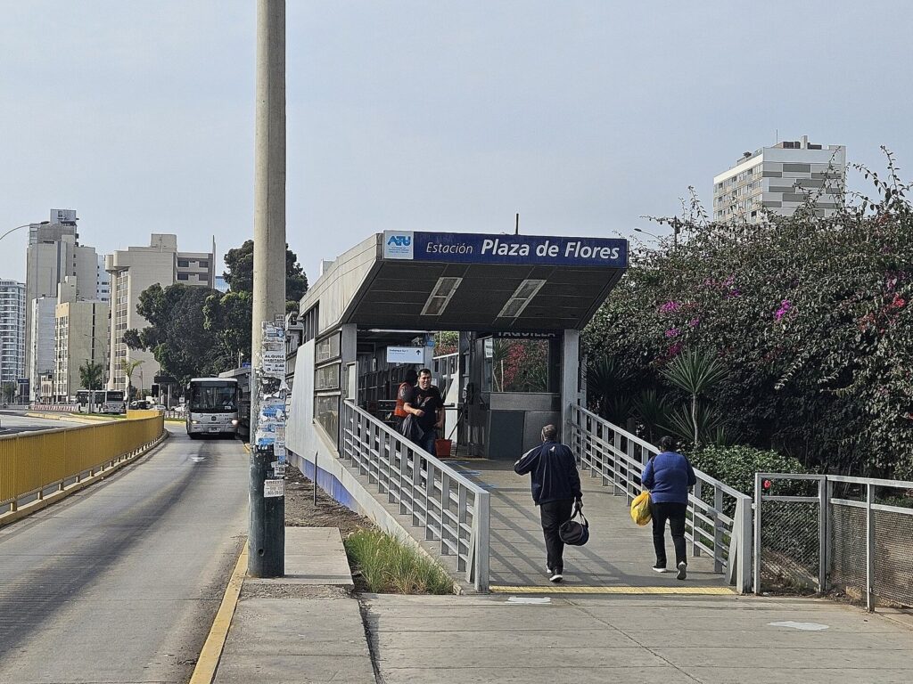
The short answer to how to get around Lima, Peru as a tourist is to walk within neighborhoods and use a ride-hailing app, such as Uber, Cabify, DiDi or inDrive, between them. For the long run between Miraflores and the historic center, the Metropolitano, a bus rapid transit line in its own lanes along the Vía Expresa, is the cheap alternative at S/ 3.20 a trip with a card. Metro Line 1 and the city’s bus corridors work for some trips, but most first-time visitors won’t need them, and the one thing to avoid is a taxi flagged down in the street.
This guide is for visitors who want to move around Lima without wasting hours or money. The caveat is traffic: TomTom’s 2025 index puts the average 10 km drive in metropolitan Lima at nearly 35 minutes, and over 51 minutes in the evening rush, so how you travel matters less than when. Lima’s fare cards are also in transition in 2026, with a single interoperable card being rolled out. Fares, hours, cards and advisories were checked on September 24, 2026, against the transport operators’ and authorities’ announcements and the UK Foreign Office’s advice.
On this page: At a glance · How the city is laid out · Route examples · Taxis and apps · Metropolitano · Your first Metropolitano ride · Bus corridors · Metro Lines 1 and 2 · Transport cards · Walking and cycling · Combis and colectivos · Transport by day plan · The airport run · Costs · Driving · At night · With children · Safety · Transport Spanish · FAQ
Lima Transport at a Glance
Fares are as published or reported on September 24, 2026. App fares aren’t fixed: the app quotes a price before you confirm, and it moves with the time of day and demand.
| Mode | Cost | Best for | Hours | The catch |
|---|---|---|---|---|
| Walking | Free | Within Miraflores, Barranco and the historic center | Any time, best by day | Distances between districts are too long to walk |
| Ride-hailing app (Uber, Cabify, DiDi, inDrive) | Quoted in the app | Between districts, at night, with luggage | Whenever drivers are available | Stuck in the same traffic as everyone; needs mobile data |
| Taxi called by your hotel or by phone | Agreed in advance | Night, early starts, airport runs | Any time you arrange | Usually dearer than an app |
| Metropolitano (bus rapid transit) | S/ 3.20 per trunk trip, plus a S/ 4.50 card | Miraflores and Barranco to the historic center | Route C: Mon to Sat 5 a.m. to 11 p.m., Sun to 10 p.m. | Card only; stations sit on the expressway, a walk from most sights |
| Corredor Azul (bus corridor) | Card only; no cash | Avenida Arequipa between Miraflores, the center and Rímac | About 5 a.m. to midnight | Runs in general traffic |
| Metro Line 1 | S/ 1.50 with its own card | La Victoria, Gamarra and the south and east of the city | 5 a.m. (Sun 5:30 a.m.) to 10 p.m. | Doesn’t reach Miraflores, Barranco or the colonial core |
| Airport Express Lima | S/ 20, or S/ 15 each for two or more | The airport to Miraflores | About hourly, roughly 7 a.m. to 10 p.m. | Serves Miraflores only |
| Taxi hailed in the street | Negotiated | Nothing | Any time | The UK Foreign Office advises against it |
How Lima’s Layout Shapes Your Transport
The places a visitor needs sit in a rough line inland from the sea: the historic center on the south bank of the Rímac River, San Isidro in the middle, and Miraflores and Barranco on the cliffs above the Pacific. Pueblo Libre, home to Museo Larco, lies to the west of that line, Callao and the airport farther west, and Pachacamac 24 km to the south of Miraflores. Within each cluster you can walk; between them, you’ll ride.
Distances are modest, but the time isn’t. The Plaza Mayor is 9.7 km by road from Parque Kennedy in Miraflores, about 34 minutes at TomTom’s 2025 citywide average and 50 minutes in the evening rush; the morning rush sits between, at 43 minutes per 10 km. That’s why the best transport plan in Lima is really a scheduling plan: one area per day, with the crossings made at quieter hours. Our Lima itinerary for first-time visitors is built that way.
Route Examples: How to Get From A to B
These are the trips visitors make most often. Distances come from OpenStreetMap routing; taxi times apply TomTom’s 2025 averages for metropolitan Lima, first the typical figure and then the evening rush.
| From and to | Road distance | By taxi or app | By public transport or on foot | Our pick |
|---|---|---|---|---|
| Miraflores (Parque Kennedy) to the historic center (Plaza Mayor) | 9.7 km | About 34 minutes; 50 in the rush | Metropolitano Route C from Ricardo Palma or Benavides to Colmena or Jirón de la Unión | App in the morning; Metropolitano on a budget |
| Miraflores to Barranco | 4.1 km | About 14 minutes; 21 in the rush | Walk the clifftop, 4.3 km to the Bridge of Sighs, about an hour | Walk there at sunset, ride back |
| Miraflores to Museo Larco | 9.9 km | About 35 minutes; 51 in the rush | No simple direct option | App |
| Barranco to the historic center | 12.9 km | About 45 minutes; 1 hour 5 in the rush | Metropolitano Route C from Plaza de Flores, Balta, Bulevar or Estadio Unión | Metropolitano, or an app outside the rush |
| Historic center to Museo Larco | 7.6 km | About 27 minutes; 39 in the rush | No simple direct option | App |
| Miraflores to the Surquillo market | 0.9 km | A few minutes | A short walk across the Vía Expresa | Walk |
| Miraflores to the Magic Water Circuit | 7.2 km | About 25 minutes; 37 in the rush | Possible by Metropolitano, but you’d return after dark | App, both ways |
| Miraflores to the airport | 19.9 km | About 1 hour 10 minutes; 1 hour 40 in the rush | Airport Express Lima from four Miraflores stops, S/ 20 | Airport Express by day, app or hotel taxi at night |
| Miraflores to the Callao pier (Palomino boats) | 17.2 km | About 1 hour; 1 hour 30 in the rush | Not practical | App |
| Miraflores to Pachacamac | 24.0 km | About 1 hour 25 minutes; 2 hours in the rush | Buses toward Lurín pass the area, but aren’t simple for a first visit | App with a booked return, a driver or a tour |
Two patterns stand out. For anything on the Miraflores to historic center axis, the Metropolitano is a real option, because it runs in its own lanes along the Vía Expresa. For everything else, the network gets complicated quickly, and an app ride is worth the money. Our guide to the best Lima neighborhoods for tourists shows which districts pair up for a day.
Taxis and Ride-Hailing Apps
Ride-hailing apps are how most visitors get around Lima. Uber, Cabify, DiDi and inDrive all operate in the city in 2026. The app shows the fare before you confirm, records the route and the driver, and spares you negotiating in Spanish; inDrive works differently, letting you propose a fare that drivers accept or counter. Peru has no specific national regulation for app-based transport, although the city’s transport authority, the ATU, has stepped up penalties for unauthorized services, and new rules were being discussed in August 2026.
The UK Foreign Office’s advice is clear: use licensed taxis booked by phone or app, and don’t hail taxis in the street. It also warns that tourists, especially those traveling alone, risk “express kidnapping,” in which victims are forced to withdraw cash from ATMs, usually at night. Street taxis in Lima don’t use meters, which is one more reason to book.
- Check before you get in. Match the plate, the car and the driver’s name with the app, and don’t get in if they differ.
- Share the trip with someone through the app, especially at night.
- Keep your phone out of sight at traffic lights, particularly with the window down.
- At your hotel, ask reception to book a taxi for late-night or early-morning rides.
- At the airport, use the authorized taxi counters in the arrivals hall, run by CMV, Mitsoo and Taxi Green, or your app’s designated pickup point.
App fares depend on distance, time of day and demand, so a trip across the city in the evening rush costs more, as well as taking longer. For long distances, such as Pachacamac or Caral, agree a price for the whole day with a driver rather than booking one-way rides.
Using the apps well
- Have data from the start. Set up an eSIM or roaming before you land, since the apps need a connection to find a driver and track the trip.
- Drop the pin precisely. Lima’s blocks are long and many streets are one-way, so set the pickup point at the exact door or a clear corner, and wait inside your hotel, restaurant or museum until the car arrives.
- Expect Spanish in the chat. Drivers may message in Spanish; the apps’ built-in translation or a short “estoy en la puerta” (I’m at the door) goes a long way.
- Watch the price at peak times. Fares rise with demand, especially in the evening rush and when it drizzles, so leave a little earlier or wait out the peak over a coffee.
- Keep small notes if you pay cash, since drivers may not have change for large bills.
The Metropolitano: Lima’s Bus Rapid Transit
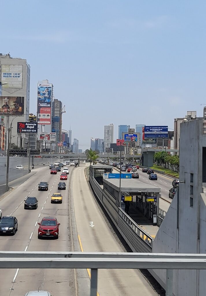
The Metropolitano is the one piece of public transport most visitors will use. Its articulated buses run in dedicated lanes, so they keep moving when the traffic beside them doesn’t, and its trunk line follows the Vía Expresa from the southern districts through Barranco and Miraflores to the historic center.
Route C, the regular all-stops service, is the one to know. It covers 24 stations between the Matellini terminal in Chorrillos and Ramón Castilla station in Cercado de Lima, and runs Monday to Saturday from 5 a.m. to 11 p.m. and on Sunday until 10 p.m. The stations visitors use are:
- Barranco area: Plaza de Flores, Balta, Bulevar and Estadio Unión.
- Miraflores: Ricardo Palma and Benavides, on the Paseo de la República at the eastern edge of the district.
- Historic center: Colmena and Jirón de la Unión, the closest to Plaza San Martín and the Plaza Mayor.
Fares and cards: a trip on the trunk line costs S/ 3.20, charged when you enter a station, and you pay with a Metropolitano card or a Lima Pass card, which costs S/ 4.50. There’s no cash fare. Express services, such as Expreso 4 between Naranjal and Plaza de Flores, skip stations, so check the route board before you board.
When it’s the right choice: for a day in the historic center from Miraflores or Barranco, especially in the rush hours, when the dedicated lanes pay off. When it isn’t: late at night, with luggage, or for places far from the expressway, such as Museo Larco. And during protests, stations can close: from June 19 to 22, 2026, the Colmena, Jirón de la Unión, Tacna and Castilla stations shut when the historic center was cordoned off.
Your First Metropolitano Ride, Step by Step
The system is straightforward once you’ve done it once. Here’s a trip from Miraflores to the historic center.
- Walk to the station. From central Miraflores, Ricardo Palma and Benavides stations sit on the Paseo de la República, the Vía Expresa, at the district’s eastern edge; you reach the platforms from the bridges and stairways above the expressway.
- Buy a card. Get a Metropolitano or Lima Pass card for S/ 4.50 at the station and load a few trips’ worth of credit.
- Tap in. The S/ 3.20 trunk fare is charged when you enter the station; there’s no charge on the way out.
- Pick the right direction. For the historic center, take a northbound service; southbound buses head toward Barranco and Chorrillos.
- Check the service. Route C stops at every station. Express services skip some, so read the route board and the sign on the bus before you board.
- Get off in the center. Colmena and Jirón de la Unión are the stops for Plaza San Martín and the Plaza Mayor, and from there you’re on foot.
Try to avoid the rush hours with luggage or small children, keep your bag in front of you in crowded buses, and top up your card before you set off so you don’t queue at the machines at peak times.
Bus Corridors: The Corredor Azul
Lima’s “complementary corridors” are bus routes with modern buses and fixed stops along major avenues. The one visitors are most likely to use is the Corredor Azul, which runs along the Tacna, Garcilaso de la Vega and Arequipa avenues between Rímac and Miraflores, with routes continuing to Barranco. It’s handy for Avenida Arequipa’s long straight run between Miraflores and the center, it’s frequent, running roughly every five minutes from about 5 a.m. to midnight, and it takes only the Lima Pass or Metropolitano card, never cash.
The catch is that the corridors share the road with other traffic, so they’re slower than the Metropolitano at rush hour. For a first visit, use the Metropolitano for the center and apps for everything else, and treat the corridors as a backup.
Metro Lines 1 and 2
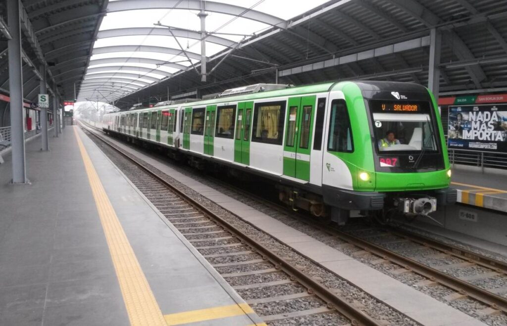
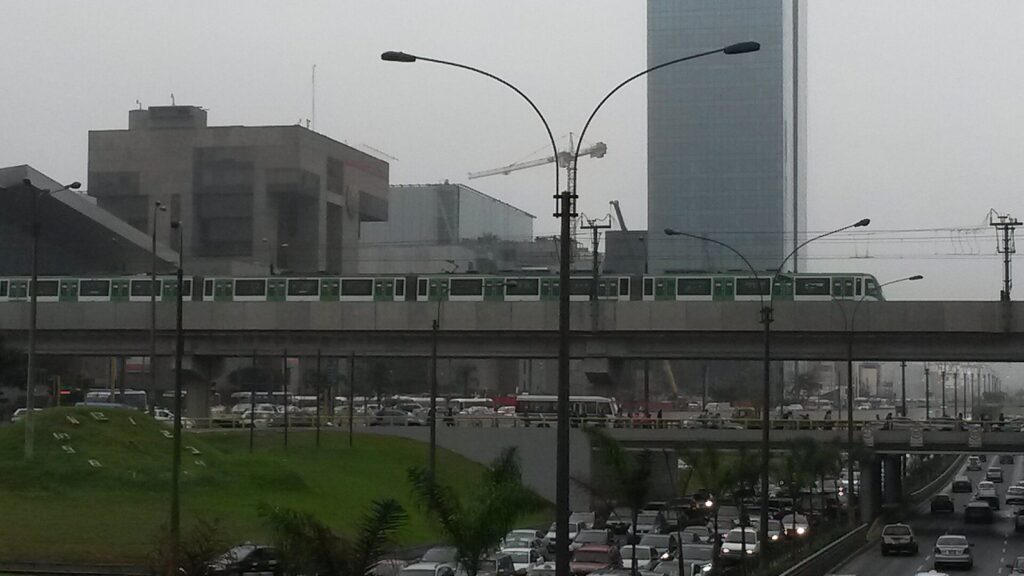
Line 1 is Lima’s elevated metro, running between Villa El Salvador in the south and Bayóvar in San Juan de Lurigancho, with 26 stations, through La Victoria and the Gamarra textile district and near central Lima. It opens at 5 a.m. from Monday to Saturday and 5:30 a.m. on Sundays and holidays, closes at 10 p.m., and costs S/ 1.50 a trip with its own rechargeable Line 1 card. For visitors it’s useful for Gamarra and for some day trips, such as reaching the Lomas de Paraíso near María Auxiliadora station, but it doesn’t reach Miraflores, Barranco or the colonial core.
Line 2, underground and much newer, runs only its first stage of five stations in the east of the city, daily from 6 a.m. to 11 p.m., for S/ 1.40 with the interoperable transport card. The stations toward central Lima were still under construction in 2026, so it isn’t useful for most visitors yet.
Transport Cards in 2026: What Should You Buy?
Lima has had three separate rechargeable cards: the Metropolitano card, the Lima Pass card and the Line 1 card. In 2026 the transport authority, the ATU, began rolling out a single interoperable card, the TIT, which costs S/ 7.50. It has been used on Line 2 since 2024, and the ATU said it would reach the Metropolitano, the corridors and buses progressively from the third quarter of 2026, while Line 1 keeps its own card for now.
For a short visit, keep it simple:
- Riding the Metropolitano or the Corredor Azul: buy a Metropolitano or Lima Pass card for S/ 4.50 and top it up with a small amount; ask at the station whether the new interoperable card is accepted there yet.
- Riding Line 1: you’ll need the Line 1 card, which you can top up at any Line 1 station.
- Riding only taxis and apps: you don’t need a card at all.
Because the rollout was still under way in late September 2026, check at the station before you buy, and don’t load more credit than you’ll use.
Walking and Cycling
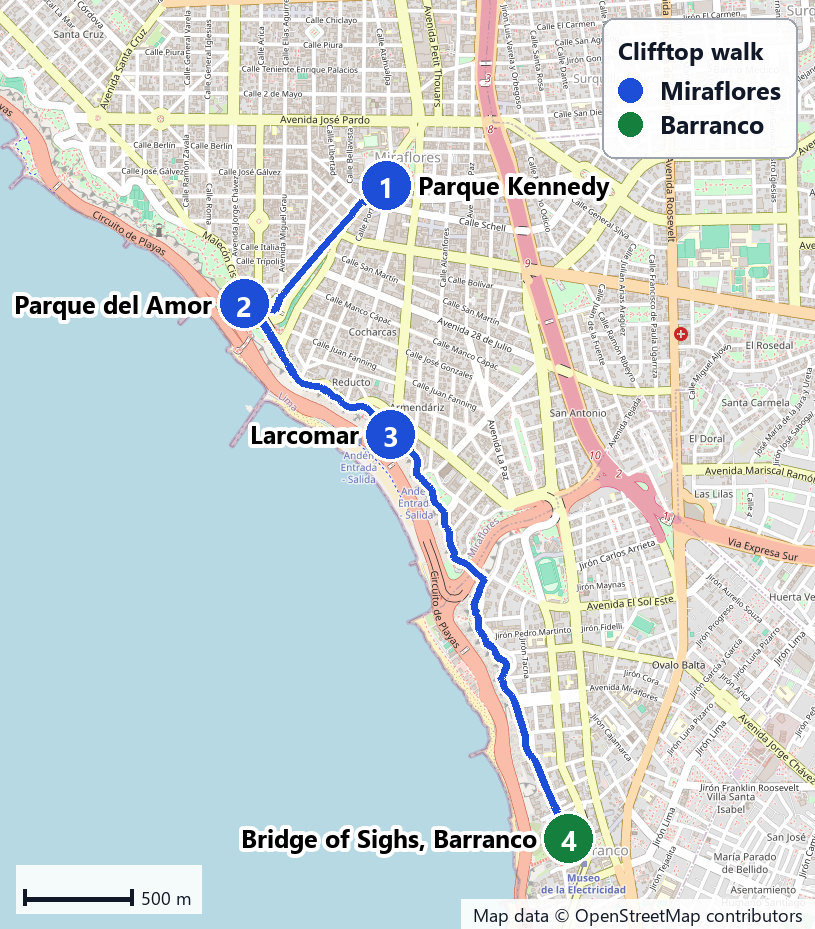
Within the main visitor areas, walking is the best way to get around. The historic center’s route from Plaza San Martín through the Plaza Mayor to San Francisco and Chinatown is about 2.9 km. In Miraflores, it’s 1.9 km from Huaca Pucllana to Parque Kennedy and 1 km from the park to the malecón, and the clifftop walk to the Bridge of Sighs in Barranco is 4.3 km, about an hour at an easy pace. Barranco’s highlights sit within a few hundred meters of each other.
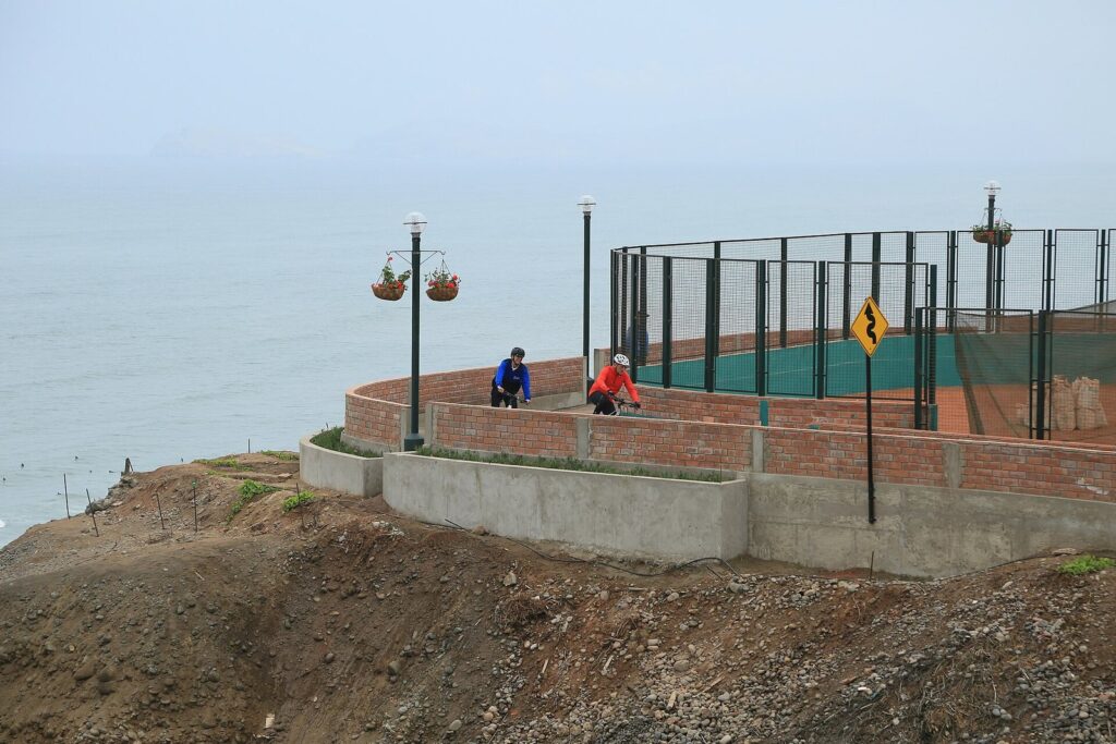
For cycling, the Miraflores malecón has a bike lane along the clifftop; in February 2024 the municipality was renewing it, with 3.3 of its 5.4 km done. The municipality has also announced a public bicycle system, CityBike Miraflores, so check whether it’s running when you visit. Away from the clifftop, riding in Lima’s traffic isn’t something we’d suggest on a first trip.
Combis and Colectivos: Should You Try Them?
Much of Lima still moves by combi, a privately run minibus, and by colectivo, a shared car on a fixed route. Their routes are painted on the side, they stop wherever someone waves, and you pay a conductor in cash. They’re cheap and they go almost everywhere, but they’re hard to read without local knowledge, crowded, and driven with more urgency than comfort.
For a first visit, we’d skip them. The Metropolitano covers the one long route most visitors need, and apps handle the rest for a price that’s still modest by international standards. If you do want to try a combi, go by day, with a local or a guide, on a short, well-known route, and keep your phone and wallet out of sight.
Transport for Each Day of a Lima Trip
If you’re following a one-area-per-day plan, the transport follows naturally. Here’s how we’d move on each of the classic days.
| Day | Getting there | Getting around | Getting back |
|---|---|---|---|
| The historic center | Metropolitano from Ricardo Palma or Benavides, or an app in the morning | On foot, about 2.9 km through the core | An app before the evening rush, or the Metropolitano |
| Museo Larco and Miraflores | An app to Pueblo Libre, 9.9 km | An app back to Miraflores after lunch, then on foot along the clifftop | You’re already there |
| Pachacamac and Barranco | An app, driver or tour to Pachacamac, 24 km | A car to Barranco, then on foot | An app from Barranco, 4.5 km to Parque Kennedy |
| Callao and the Palomino Islands | An app to the pier at Plaza Grau, 17.2 km | An app between the pier, La Punta and Callao Monumental | An app before the evening rush |
| A long day trip | A tour or a hired driver | The tour or the site’s guide | The same vehicle |
The Airport Run
The airport is in Callao, and since June 2025 every flight uses the new terminal, 19.9 km by road from Parque Kennedy on the way out: about 1 hour 10 minutes at TomTom’s 2025 average, and 1 hour 40 minutes in the evening rush. The official Airport Express Lima bus runs between the terminal and four stops in Miraflores for S/ 20, or S/ 15 each for two or more, roughly hourly from morning to about 10 p.m. At the terminal, authorized taxis are sold at counters in the arrivals hall, run by CMV, Mitsoo and Taxi Green, and app taxis can also pick up. For departures, the airport operator asks international passengers to arrive at least three hours before takeoff, so for an evening flight from Miraflores, leave close to five hours ahead. Our Lima airport guide covers the new terminal step by step.
What Does Getting Around Lima Cost?
Transport is one of the cheaper parts of a Lima trip if you mix modes sensibly. A day that uses the Metropolitano to reach the center and back costs S/ 6.40 in fares, plus S/ 4.50 for the card on the first day. The Airport Express is S/ 20 each way per person, or S/ 15 each for two or more. App rides are the variable: they’re priced by distance, time and demand, so a morning ride across the city costs less than the same ride in the evening rush. Grouping each day by area, with one longer crossing instead of several, keeps both the fares and the hours in traffic down.
Should You Rent a Car in Lima?
Not for getting around the city. TomTom’s 2025 figures, nearly 35 minutes per 10 km on average and 51 minutes in the evening rush, apply to you too, and parking, navigation and local driving habits add their own stress. Rental companies have a pickup lot beside the new airport terminal, and a car makes sense for trips out of the city, such as Lachay, which you can visit without an operator, or a road trip south. Inside Lima, apps and the Metropolitano will get you around faster and with less stress.
Getting Around at Night
After dark, use an app or a taxi booked by your hotel, and avoid hailing one in the street. Public transport winds down earlier than many visitors expect: Metropolitano Route C runs until about 11 p.m. from Monday to Saturday and 10 p.m. on Sunday, Line 1 until 10 p.m., and the Airport Express’s last departures are around 10 p.m. The Corredor Azul runs until about midnight. Evening plans such as dinner in Barranco, the Magic Water Circuit or Huaca Pucllana’s night visits are app-ride evenings, and the FCDO’s warning about express kidnappings, usually at night, is the reason to take them.
Getting Around With Limited Mobility
For travelers with limited mobility, taxis and apps are the most reliable option, since they go door to door; tell the driver about a wheelchair when you book. The Miraflores malecón is broad and mostly level, and the Jirón de la Unión in the historic center is pedestrian, but many other sidewalks are narrow, busy or uneven, and Barranco’s Bajada de los Baños has steps. Ask stations and venues about access before you rely on them.
Getting Around With Children
With young children, door-to-door apps are the easiest option, especially after dark. If you need a car seat, bring your own or book a private transfer that promises one, since you can’t count on an app car having it. Strollers work well on the Miraflores malecón and the pedestrian Jirón de la Unión, less well on narrow or broken sidewalks elsewhere, and the Metropolitano is best tried with children outside the rush hours. The Airport Express, with no luggage limit according to 2026 guides, is a simple way to reach Miraflores with bags and kids in daylight.
Safety on Lima’s Streets and Transport
The UK Foreign Office says street crime, including muggings, is a significant problem in Lima, and that attacks can happen in tourist areas such as Miraflores and Barranco. On public transport and on foot, the sensible habits are the same everywhere: keep your phone and wallet out of sight, carry only the cash you need, and use ATMs inside banks or malls in daylight. A 60-day state of emergency declared on August 28, 2026, covers Lima Metropolitana and Callao, and protests can close roads and Metropolitano stations in the historic center at short notice, so check the news before a center day.
Transport Spanish: Words You’ll Need
| Spanish | English | Where you’ll use it |
|---|---|---|
| Paradero | Bus stop | Corridors, combis |
| Estación | Station | Metropolitano, Metro |
| Tarjeta / recarga | Card / top-up | Metropolitano, corridors, Metro |
| Pasaje / medio pasaje | Fare / half fare (students) | All public transport |
| Carril exclusivo | Dedicated bus lane | The Metropolitano’s corridor |
| ¿Me deja en…? | Can you drop me at…? | Taxis and apps |
| Estoy en la puerta | I’m at the door | App pickups |
| ¿Cuánto es? | How much is it? | Taxis, combis |
| Bajo en la próxima | I’m getting off at the next stop | Combis and buses |
Getting Around Lima FAQ
What is the best way to get around Lima as a tourist?
Walk within neighborhoods and use a ride-hailing app such as Uber, Cabify, DiDi or inDrive between them. For trips between Miraflores or Barranco and the historic center, the Metropolitano is a cheap alternative in its own lanes, at S/ 3.20 a trip with a card. Avoid taxis hailed in the street, as the UK Foreign Office advises.
Can you pay for the Metropolitano in cash?
No. You pay with a Metropolitano card or a Lima Pass card, which costs S/ 4.50, and each trunk-line trip costs S/ 3.20. The Corredor Azul also takes only those cards. A new interoperable card is being rolled out from the third quarter of 2026, so ask at the station which cards it accepts.
Is there a metro to Miraflores?
No. Metro Line 1 runs between Villa El Salvador and San Juan de Lurigancho, well east of Miraflores and Barranco, and Line 2 runs only in the east so far. The Metropolitano bus rapid transit line is the rapid transit that serves Miraflores, with Ricardo Palma and Benavides stations on the Vía Expresa.
How do you get from Miraflores to the historic center?
By app, it’s 9.7 km, about 34 minutes at TomTom’s average for Lima and 50 in the evening rush. By Metropolitano, take Route C from Ricardo Palma or Benavides to Colmena or Jirón de la Unión, for S/ 3.20 with a card. Go in the morning and come back before the evening rush.
Do Lima’s taxis use meters?
No. Street taxis don’t use meters, so fares are negotiated, which is one reason to book through an app, where the price is shown before you confirm, or through your hotel. The UK Foreign Office advises using licensed taxis booked by phone or app rather than hailing them.
How much should you budget for getting around Lima?
It depends on how much you ride. A Metropolitano trip costs S/ 3.20 plus a S/ 4.50 card, and the Airport Express to Miraflores S/ 20. App fares vary with distance, time and demand, and a cross-city trip in the evening rush costs more than the same trip at midday. Grouping each day by area saves both time and fares.
Related Lima Guides
- Lima Airport Guide for International Arrivals: the official bus, authorized taxis and drive times from the new terminal.
- Lima, Peru Itinerary for First-Time Visitors: day plans built around the traffic.
- Best Lima Neighborhoods for Tourists: which districts to pair on the same day.
- Where to Stay in Lima, Peru for Tourists: the drive from each base to the sights and the airport.
- Best Day Trips From Lima, Peru: honest door-to-door times for trips out of the city.
Sources and How We Checked
Fares, hours, cards and advisories on this page were checked on September 24, 2026, against the sources listed below. The guide is compiled from them, not from other travel lists, and it claims no first-hand trips. Drive times combine OpenStreetMap routing with TomTom’s 2025 Lima averages.
- Metropolitano and cards: Infobae on Metropolitano fares, ATU on Metropolitano and Lima Pass cards, El Comercio’s 2026 Metropolitano guide, Metropolitano route listings (independent site), Infobae on the interoperable card
- Corridors and metro: Corredor Azul listings (independent site), Line 1 listings (independent site), Andina on the Line 1 fare, Metro Line 2 hours and fares, OSITRAN on Line 2 construction
- Apps and taxis: La República on ride-hailing rules, Lima Airport authorized taxis, Airport Express Lima
- Walking and cycling: Municipality of Miraflores on the malecón bike lane, OpenStreetMap routing
- Traffic and safety: TomTom Traffic Index for Lima, OSRM, UK FCDO travel advice for Peru, Infobae on the June 2026 closure, Andina on the state of emergency
Lima Tourism Guide is an independent publication. We are not affiliated with PROMPERÚ, the Municipality of Lima or any attraction listed here, and no one paid to be included.
Photo Credits
- Plaza de Flores Metropolitano station: photo by TomasVial, Wikimedia Commons (CC0)
- Vía Expresa and Metropolitano station: photo by Epidemia2023x, Wikimedia Commons (CC BY-SA 4.0)
- Metro Line 1 train: photo by Elelch, Wikimedia Commons (CC BY-SA 3.0)
- Metro Line 1 viaduct: photo by Elelch, Wikimedia Commons (CC BY-SA 4.0)
- Map of the Miraflores to Barranco walk: Lima Tourism Guide, drawn from map data © OpenStreetMap contributors (ODbL)
- Clifftop bike path, Miraflores: photo by Municipalidad de Miraflores, Wikimedia Commons (CC BY 2.0)