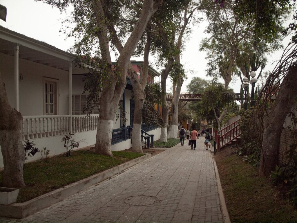
The best Lima neighborhoods for tourists are Miraflores, for the clifftop walks above the Pacific; Barranco, for old mansions, art museums and nights out; and the historic center, for colonial Lima. With more time, add San Isidro for its centuries-old olive grove, Pueblo Libre for Museo Larco and an old tavern, Chorrillos for the view from the Morro Solar, and Callao for the port’s restored streets and the seafront at La Punta. Each district has its best hour: the center in the morning, the coast at sunset, Barranco after dark.
This guide is about visiting Lima’s neighborhoods, not about where to sleep; our guide to where to stay in Lima compares them as bases. The caveat that shapes any neighborhood plan is distance: the Plaza Mayor is 9.7 km by road from Parque Kennedy in Miraflores, about 35 minutes at TomTom’s 2025 average for Lima, so group the districts that sit next to each other. Opening hours, fees and closures were checked on September 24, 2026, against the municipalities’, museums’ and agencies’ own websites.
On this page: At a glance · How the districts fit together · Miraflores · Barranco · Historic center · Rímac · San Isidro · Surquillo · Pueblo Libre · Chorrillos · Callao and La Punta · Residential districts · By interest · Walking routes · Day or night · Season · Combining neighborhoods · Getting between them · Free things · Accessibility · Safety · FAQ
Lima Neighborhoods at a Glance
Road distances are measured on OpenStreetMap routing from Parque Kennedy, and drive times apply TomTom’s 2025 average for metropolitan Lima, 34 minutes 53 seconds per 10 km. The time to allow is our planning estimate for a first visit.
| Neighborhood | Character | Don’t miss | Best time | From Parque Kennedy | Time to allow |
|---|---|---|---|---|---|
| Miraflores | Clifftop parks, towers, restaurants | The malecón, Huaca Pucllana, Parque del Amor | Late afternoon to sunset | You’re there | Half a day |
| Barranco | Old mansions, galleries, bars | Bridge of Sighs, Bajada de Baños, two museums | Late afternoon into the evening | 4.1 km, about 15 minutes | Half a day |
| Historic center | Colonial plazas, churches, Chinatown | Plaza Mayor, San Francisco catacombs | Morning to mid-afternoon | 9.7 km, about 35 minutes | A full day |
| Rímac | Old viceregal quarter across the river | Alameda de los Descalzos, Paseo de Aguas | By day, with a guide | 12.1 km, about 40 minutes | 1 to 2 hours |
| San Isidro | Leafy, residential, business | Bosque El Olivar, Huaca Huallamarca | Morning | 4.0 km, about 15 minutes | 2 hours |
| Surquillo | Working-class district next to Miraflores | Mercado N° 1 | Late morning, for lunch | 0.9 km | 1 to 2 hours |
| Pueblo Libre | Quiet, old-fashioned, museums | Museo Larco, Plaza Bolívar, Queirolo tavern | Morning | 8.7 km, about 30 minutes | Half a day |
| Chorrillos | Fishing bay under a headland | The Morro Solar viewpoint | A clear afternoon | 7.2 km, about 25 minutes | 2 to 3 hours |
| Callao and La Punta | Lima’s port, restored streets, seafront | Callao Monumental, La Punta’s malecón, the Palomino boats | By day | 17.1 km to La Punta, about 1 hour | Half a day |
How Lima’s Districts Fit Together
Lima Metropolitana is made up of 43 districts, and Callao, home to the port and the airport, is a separate region next door. The historic center is the district of Cercado de Lima, on the south bank of the Rímac River; Rímac, the district across the river, is the city’s other colonial quarter. South of the center, the neighborhoods visitors use form a rough line toward the sea: San Isidro in the middle, then Miraflores and Barranco along the cliffs above the Pacific, with Chorrillos beyond them under the Morro Solar headland. Pueblo Libre, Jesús María, Lince, Magdalena and San Miguel fill the space west of that line, between the center and the coast.
That shape explains how to plan. Miraflores, Barranco, San Isidro and Surquillo sit close enough to walk or take a short taxi between them. The center and Rímac are a separate trip, and Callao is another. In PROMPERÚ’s 2024 survey of foreign tourists, the most visited places in Lima were the historic center (46%), the Plaza de Armas (39%), Parque Kennedy (39%) and Larcomar (38%), so most visitors see two of these clusters and miss the rest.
Miraflores: Clifftops and the City’s Busiest Parks
Miraflores is where most visitors spend most of their time, and it’s the easiest neighborhood to enjoy without a plan. Its malecón, the clifftop path, runs 5.4 km from the San Isidro boundary to Barranco, lined with parks where you can watch the paragliders launch and the surf roll in below. Parque del Amor, opened on February 14, 1993, is built around Víctor Delfín’s sculpture El Beso, and Larcomar, the shopping center set into the cliff, is the classic sunset spot.
Inland, Parque Kennedy is the district’s busy heart, and Huaca Pucllana, an adobe pyramid built between AD 450 and 650, rises between apartment blocks a 28-minute walk away; it’s closed on Tuesdays. LUM, the Place of Memory, a free museum about the internal conflict of 1980 to 2000, sits on the Bajada San Martín and closes on Mondays. A bike lane runs along the malecón, and the municipality’s tourist information center is on Avenida José Larco at block 7, open Monday to Friday from 9 a.m. to 6 p.m.
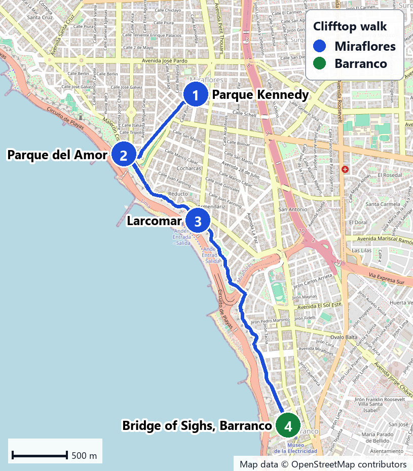
The clifftop walk to Barranco: the best way to see both districts is on foot. From Parque Kennedy it’s 993 m to Parque del Amor, 982 m along the clifftop to Larcomar, and 2.3 km more to the Bridge of Sighs in Barranco: 4.3 km in all, about an hour at an easy pace, and mostly on the clifftop parks. Start around 4 p.m. and you’ll reach Barranco near sunset, which falls between about 5:50 and 6:40 p.m. depending on the month.
Plan it: Huaca Pucllana costs S/ 15 with a guided walk and opens 9 a.m. to 5 p.m.; LUM is free. Tandem paragliding from the Parapuerto costs S/ 260 to S/ 300, weather permitting, from 10 a.m. until sunset.
Barranco: Old Houses, Art and Nights Out
Barranco, directly south of Miraflores, is the district of old mansions, galleries and bars, and it’s at its best from late afternoon into the evening. The Puente de los Suspiros, the Bridge of Sighs, is a short wooden footbridge over the Bajada de los Baños, a tree-shaded stone path that runs down to the sea between old houses. It’s steep in places and has steps, so it isn’t step-free, and it gets busy on weekend evenings.
Two museums sit a few blocks apart. Museo Pedro de Osma, in a Republican-era mansion, shows colonial paintings, silverwork and furniture and lends wheelchairs at the entrance; MAC Lima, the contemporary art museum, is on Avenida Grau. Both close on Mondays. After dark, Barranco’s bars are the draw, and several of the city’s most famous restaurants are here, including Central and Kjolle, which share an address on Avenida Pedro de Osma.
Plan it: Museo Pedro de Osma is open Tuesday to Sunday, 10 a.m. to 6 p.m., for S/ 35; MAC Lima opens Tuesday to Sunday, 10 a.m. to 7 p.m., for S/ 20. If you’d planned to swim below the cliffs, check the water first: in January 2026, DIGESA rated Barranco’s Los Pavos and Las Sombrillas beaches unfit for bathers.
The Historic Center: Colonial Lima
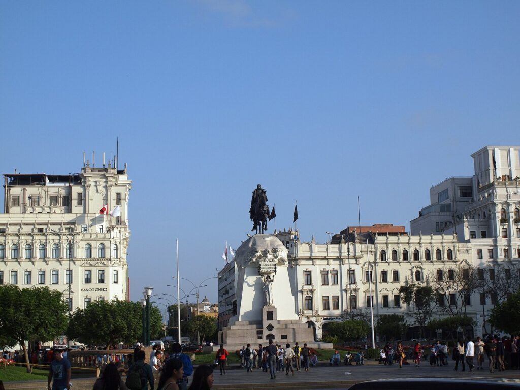
The historic center, Cercado de Lima, is the colonial city that UNESCO inscribed on the World Heritage List in 1988 and extended in 1991. It’s a walking neighborhood: from Plaza San Martín, the pedestrian Jirón de la Unión runs 950 m to the Plaza Mayor, where the Cathedral, the Government Palace and the Municipal Palace face each other and the palace guard changes at noon. A few blocks away are the San Francisco convent and its catacombs, the Santo Domingo convent, the Casa de la Literatura in the old Desamparados railway station, and Chinatown, around Calle Capón, about 1 km from the Plaza Mayor.
Go in the morning and stay until mid-afternoon. The center is at its most rewarding while the churches and museums are open, and it’s where protests and security operations happen: from June 19 to 22, 2026, the Municipality of Lima and the National Police closed a perimeter that included the Plaza Mayor and Plaza San Martín. Check the news before you go.
Plan it: a walking loop from Plaza San Martín through the Plaza Mayor, Santo Domingo, the Casa de la Literatura and San Francisco to Chinatown is about 2.9 km. The Cathedral charges S/ 30 and San Francisco sells tickets at the door. Santo Domingo, MALI and the Casa de la Literatura close on Mondays. Our Lima itinerary times the whole center day, stop by stop.
South of the core: MALI and the Magic Water Circuit
Cercado de Lima stretches south of the colonial core to two big parks on the way to the coast. In the Parque de la Exposición, MALI, the Lima Art Museum, covers Peruvian art from ancient times to the present; it opens Tuesday to Sunday from 10 a.m. to 6 p.m., closing at 5 p.m. on Saturdays, and foreign visitors pay S/ 40. A little farther south, the Magic Water Circuit in the Parque de la Reserva opens daily from 3 to 10 p.m., with water, light and laser shows at 7:15, 8:15 and 9:10 p.m., for S/ 7. Both sit on the route between the center and Miraflores, which makes them good stops on the way back.
Rímac: The Other Colonial Quarter
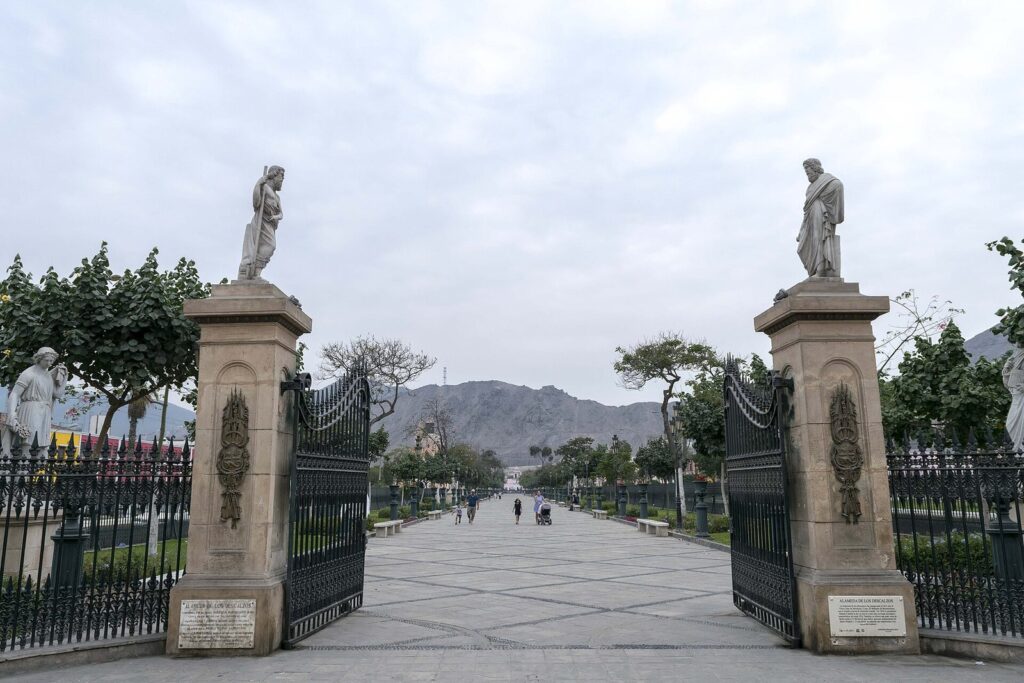
Rímac, across the river from the Plaza Mayor, keeps some of the viceregal city’s grandest promenades. The Alameda de los Descalzos is lined with statues, and next to it the Paseo de Aguas was built in 1772 under Viceroy Manuel de Amat y Junient. Above them rises Cerro San Cristóbal, which Lima’s parks service gives as 400 m above sea level, with views on clear days to the beaches of Chorrillos and La Punta and the islands of San Lorenzo and El Frontón.
Plan it: Rímac is 12.1 km from Parque Kennedy, about 40 minutes by car, or a short crossing of the river from the Plaza Mayor. Visit by day and go with a licensed guide or an organized tour, both for the context and because access to the San Cristóbal summit changes; confirm how you’ll get up and down before you go. It’s a one- to two-hour add-on to a center day, not a full outing.
San Isidro: Olive Trees and a Pyramid
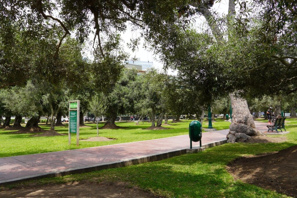
San Isidro is Lima’s business district and one of its greenest residential areas, and for a visitor its highlight is the Bosque El Olivar: 1,946 olive trees across 10 hectares, some planted more than 350 years ago, declared a National Monument in 1959. The district says the first olive trees arrived in 1560. It’s a lovely hour’s walk, especially in the morning.
Huaca Huallamarca, an adobe pyramid on Avenida Nicolás de Ribera, is the district’s other sight: smaller than Huaca Pucllana and much quieter, open Tuesday to Saturday and on the first Sunday of the month from 9 a.m. to 5 p.m., for S/ 5. That makes it the natural substitute on a Tuesday, when Pucllana is closed.
Plan it: San Isidro is 4.0 km from Parque Kennedy, about 15 minutes by car, and 5.7 km from Museo Larco, so it pairs well with a Pueblo Libre morning.
Surquillo: The Market Next Door
Surquillo, across the Vía Expresa from Miraflores, is a working-class district that most visitors cross without noticing, except for one address: the Mercado N° 1, on Avenida Paseo de la República, only 0.9 km by road from Parque Kennedy. It’s the best place near the coast to see Peru’s fruit, potatoes and chilies piled in one hall, and its counters serve cooked lunches. Go in the late morning and eat there. Our Lima food guide explains what to order.
Pueblo Libre: Museums and an Old Tavern
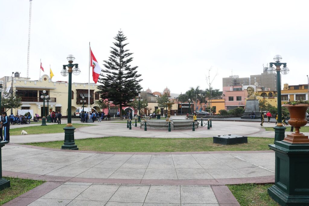
Pueblo Libre is a quiet, old-fashioned residential district with two of Lima’s most important museums. Museo Larco, on Avenida Simón Bolívar with its entrance on Calle Navarra, is open every day from 9 a.m. to 7 p.m., and its café-restaurant on the terraces can be visited without a museum ticket. The national museum of archaeology, anthropology and history is on Plaza Bolívar, a 1.5 km walk away, free and closed on Mondays. Antigua Taberna Queirolo, a bar-restaurant whose story began in 1880, is 1.4 km from Museo Larco.
Plan it: Pueblo Libre is 8.7 km from Parque Kennedy, about 30 minutes by car. Museo Larco charges S/ 50 at the door or S/ 45 online. Make it a morning, with lunch in the district.
Chorrillos: The Bay and the Morro Solar
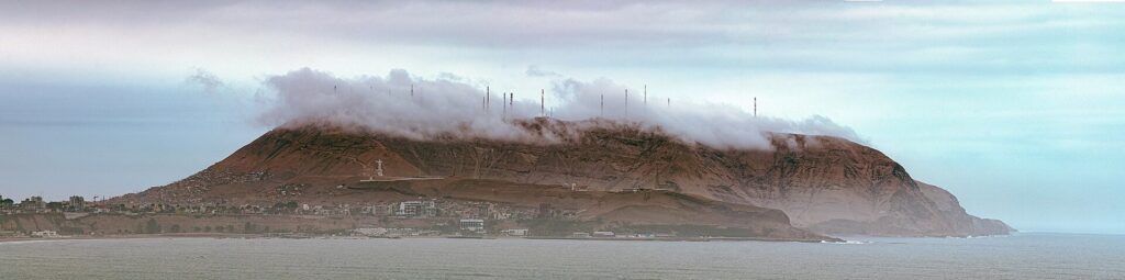
Chorrillos, south of Barranco, curves around a bay beneath the Morro Solar, the headland you see to the south from the Miraflores clifftops. On top stands the Cristo del Pacífico, a 37-meter statue of Christ inaugurated in 2011, and the municipality has opened a clifftop promenade of about 2 km on the Morro that it calls the Gran Mirador de Lima. On a clear afternoon the view back over the coast is one of the best in the city; in the gray months the summit is often in cloud, as in the photo above.
Plan it: Chorrillos’ seafront, the Malecón Grau, is 7.2 km from Parque Kennedy, about 25 minutes by car, and the Morro Solar is a taxi ride above it. Go on a clear day and don’t go just for the beaches: in January 2026, DIGESA rated the La Herradura and Villa beaches unfit for bathers.
Callao and La Punta: Lima’s Port
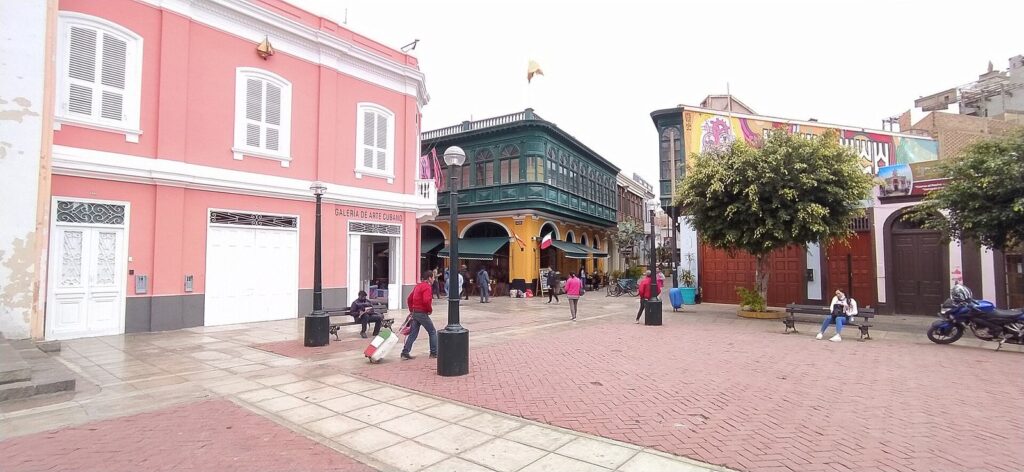
Callao, a separate region with its own government, is Lima’s port and home to the airport. For visitors it offers three things. Callao Monumental, the restored old port, is, in PROMPERÚ’s words, a neighborhood of galleries and exhibitions, good for a cultural afternoon. The Real Felipe fortress, the colonial fort by the harbor, opens daily from 9 a.m. to 4 p.m., with guided visits in Spanish lasting 2 hours 30 minutes and a flat S/ 15 ticket for foreign visitors. And La Punta, at the tip of the peninsula, has a seafront promenade lined with old republican-era houses, calm water for swimming and restaurants, and is busiest in summer.
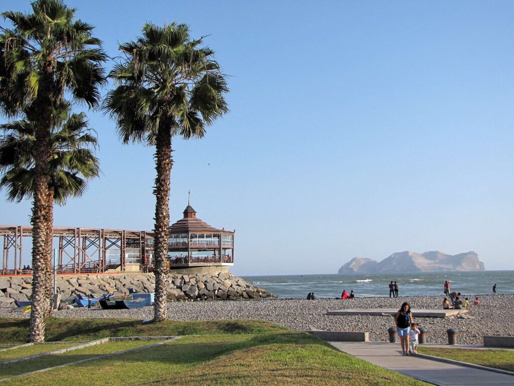
Plan it: La Punta is 17.1 km from Parque Kennedy, about an hour by car, and the Palomino Islands boats leave from the pier at Plaza Grau in Callao, so combine them: boat in the morning, lunch in La Punta, Callao Monumental in the afternoon. Travel by app taxi and visit by day, and our guide to day trips from Lima has the boat details.
The Residential Districts: Jesús María, Lince, Magdalena and San Miguel
Between the center and the coast lie districts where Limeños live and visitors rarely go. Each has one reason to stop.
- Jesús María: the Natural History Museum of San Marcos University, founded in 1918, at Avenida Arenales 1256, with Peruvian fauna, flora, fossils and minerals; 2026 listings give Tuesday to Friday, 9 a.m. to 5 p.m., and Saturday, 10 a.m. to 5 p.m. The Campo de Marte, a large park, is 8.4 km from Parque Kennedy.
- Lince: a compact residential district 5.5 km from Parque Kennedy, centered on the Parque Mariscal Castilla, with neighborhood restaurants and set lunches rather than sights.
- Magdalena del Mar: on the cliffs north of San Isidro, 6.9 km from Parque Kennedy; Condor Xtreme’s tandem paragliding flights launch from the Costa Verde here.
- San Miguel: home to Parque de las Leyendas, Lima’s zoo, 11.7 km from Parque Kennedy, where adults pay S/ 20 and children aged 3 to 12 pay S/ 10.
Which Neighborhoods Suit Your Interests?
If you only have time for a few districts, choose by what you want to see. Most interests point to two or three neighborhoods that sit close together.
| Interest | Neighborhoods | What you’ll find |
|---|---|---|
| Colonial history and architecture | Historic center, Rímac, Callao Monumental | Plazas, churches, carved balconies, viceregal promenades and the old port |
| Ancient Peru | Pueblo Libre, Miraflores, San Isidro | Museo Larco and the national museum, plus two adobe pyramids, Huaca Pucllana and Huaca Huallamarca |
| Art | Barranco, the Parque de la Exposición | MAC Lima and Museo Pedro de Osma, and MALI’s collection from ancient to modern |
| Food | Surquillo, the historic center, Barranco, Miraflores | The Mercado N° 1, Chinatown’s chifas, criollo taverns and famous tasting menus |
| The sea and views | Miraflores, Chorrillos, La Punta | The clifftop malecón, the Morro Solar lookout and a seafront promenade |
| Nightlife | Barranco, Miraflores | Bars, late dinners and the lit-up clifftop |
| Families | Miraflores, San Miguel, Jesús María, Cercado | Clifftop parks, the zoo, the natural history museum and the Magic Water Circuit |
Walking Routes in Each Neighborhood
Lima’s neighborhoods are best seen on foot once you’re in them. These routes use OpenStreetMap’s walking directions; the times are for an easy pace without stops.
| Neighborhood | Route | Distance | Time |
|---|---|---|---|
| Historic center | Plaza San Martín, Plaza Mayor, Santo Domingo, Casa de la Literatura, San Francisco, Chinatown | About 2.9 km | About 40 minutes walking, plus visits |
| Miraflores to Barranco | Parque Kennedy, Parque del Amor, Larcomar, the Bridge of Sighs | 4.3 km | About 1 hour |
| Miraflores inland | Huaca Pucllana to Parque Kennedy | 1.9 km | About 28 minutes |
| Barranco | Museo Pedro de Osma to the Bridge of Sighs and the Bajada de Baños | 725 m, then 193 m | About 15 minutes |
| Pueblo Libre | Museo Larco to Plaza Bolívar and the national museum | 1.5 km | About 19 minutes |
The center’s route follows the order in which its stops close: Santo Domingo shuts from 1 to 2 p.m. and all day Monday, while San Francisco is open daily. On the clifftop walk, keep to the malecón parks, which are the most pleasant stretch and the busiest.
Neighborhoods by Day and by Night
Timing is half of enjoying Lima’s neighborhoods. The historic center, Rímac, Callao and Pueblo Libre are daytime districts: their sights close by the late afternoon, and the center’s museums and churches keep office-style hours. San Isidro’s olive grove is at its best in the morning light.
The coast comes alive later. Miraflores’ clifftop parks fill up in the late afternoon, and the sun sets between about 5:50 and 6:40 p.m. depending on the month, by our calculation from NOAA’s solar equations. Barranco’s bars and restaurants take over after dark. Two sights are specifically evening plans: the Magic Water Circuit, with shows at 7:15, 8:15 and 9:10 p.m., and Huaca Pucllana’s night visits, which run Wednesday to Sunday by reservation for S/ 17. Between districts at night, book taxis by app or phone.
Does the Season Change Which Neighborhoods to Visit?
From about December to April, Lima’s summer, the coastal districts are at their best: clear sunsets over the Miraflores cliffs, crowds on the beaches below Barranco and Chorrillos, and La Punta at its busiest. Check the water before you swim, because DIGESA rated several Barranco and Chorrillos beaches unfit for bathers in January 2026.
From about June to November, a low marine cloud usually covers the coast, with a fine drizzle called garúa rather than real rain. The Morro Solar is often in cloud, sea views go gray, and the museum districts, Pueblo Libre and the historic center, earn more of your time. The same mist turns the hills around Lima green from about July to October, which is the season for the lomas day trips.
Combining Neighborhoods in One Day
The districts that sit together make the best days. These pairings keep the driving short.
| Pairing | Distance | Why it works |
|---|---|---|
| Miraflores and Barranco | 4.3 km on foot along the clifftop | Walk from Parque Kennedy in the afternoon and arrive in Barranco for sunset and dinner |
| The historic center and Rímac | Across the river from the Plaza Mayor | Add Rímac’s promenades to a center morning, with a guide |
| Pueblo Libre and San Isidro | 5.7 km from Museo Larco to Huaca Huallamarca | Museums in the morning, the olive grove after lunch |
| Callao and La Punta | Both on the Callao peninsula | The Palomino boat, a seafood lunch and the old port |
| Barranco and Chorrillos | Neighboring districts on the coast | The Morro Solar view on a clear afternoon, then Barranco after dark |
| Miraflores and Surquillo | 0.9 km | A market lunch, then the clifftops |
Getting Between Lima’s Neighborhoods
Taxis booked by app or phone are the practical way to move between districts; the UK Foreign Office advises against hailing taxis in the street. The Metropolitano bus rapid transit line links Miraflores with the center along the Vía Expresa: its all-stops Route C runs from Ricardo Palma and Benavides stations in Miraflores to Colmena and Jirón de la Unión stations in the center, and each trunk trip costs S/ 3.20 with a card that costs S/ 4.50. Within Miraflores and Barranco, walking is the best option, and the malecón has a bike lane.
Budget for traffic. At TomTom’s 2025 averages, the 9.7 km from Parque Kennedy to the Plaza Mayor takes about 34 minutes on average and 50 minutes in the evening rush, and La Punta, at 17.1 km, takes about an hour. Short hops, such as Miraflores to Barranco or San Isidro, take around 15 minutes.
Free Things to Do, Neighborhood by Neighborhood
Some of Lima’s best neighborhood experiences cost nothing, which makes a wandering day cheap even if the taxis between districts aren’t.
- Miraflores: the 5.4 km clifftop malecón, Parque del Amor, Parque Kennedy and LUM, the Place of Memory, which is free.
- Barranco: the Bridge of Sighs and the walk down the Bajada de los Baños to the sea.
- Historic center: the Plaza Mayor, the changing of the guard at noon, the walk down Jirón de la Unión, Plaza San Martín and the Casa de la Literatura Peruana.
- Pueblo Libre: the national museum of archaeology, anthropology and history, listed as free for every category of visitor.
- San Isidro: a walk through the Bosque El Olivar.
- Callao: La Punta’s seafront promenade and the streets of Callao Monumental.
Neighborhoods for Visitors With Limited Mobility
Lima’s neighborhoods vary a lot underfoot. Miraflores is the easiest: the clifftop malecón is broad and mostly level, and Larcomar and the parks along it are designed for crowds. The historic center’s main walk down Jirón de la Unión is pedestrian, though side streets and church entrances can be uneven. Barranco is harder: the Bajada de los Baños is steep in places and has steps, so it isn’t step-free.
Several museums in these neighborhoods are well equipped. Museo Larco in Pueblo Libre has ramps to its galleries and gardens and lends wheelchairs for free; MALI has ramps, lifts and adapted toilets; Museo Pedro de Osma in Barranco lends wheelchairs at the entrance; and Huaca Pucllana in Miraflores has Pukllaywasi, an interactive room designed for visitors with visual impairments and for children. For the rest, contact the venue before you go, and book app taxis with enough space for a wheelchair.
Safety by Neighborhood: What the Advisories Say
We don’t label any Lima neighborhood safe or unsafe, because the official advice doesn’t. The UK Foreign Office says street crime, including muggings, is a significant problem in Lima and other major cities, and that attacks can happen in tourist areas such as Miraflores and Barranco. It also warns that tourists, especially those alone, risk “express kidnapping,” in which victims are forced to withdraw cash from ATMs, usually at night.
In practice, that means the same habits everywhere: taxis by app or phone, phones out of sight on busy sidewalks, cash from ATMs inside banks or malls in daylight, and extra care after dark. A 60-day state of emergency declared on August 28, 2026, covers Lima Metropolitana and Callao, and protests can close parts of the historic center at short notice. For Rímac and Callao’s historic streets, going by day with a guide or an organized tour gives you context as well as company.
Lima Neighborhoods FAQ
What is the best neighborhood in Lima for a first visit?
Miraflores, because its clifftop parks, Huaca Pucllana and Larcomar are all on foot, and Barranco is a walk away along the cliffs. But don’t stop there: the historic center is the reason Lima is a UNESCO World Heritage city, and a morning in Pueblo Libre at Museo Larco is the best introduction to ancient Peru.
Can you walk from Miraflores to Barranco?
Yes. From Parque Kennedy it’s 4.3 km to the Bridge of Sighs on OpenStreetMap’s walking route, about an hour, most of it along the clifftop past Parque del Amor and Larcomar. Start in the late afternoon and you’ll reach Barranco around sunset, then take a taxi back after dinner.
Is the historic center worth visiting?
Yes, for at least a morning. The Plaza Mayor, the Cathedral, the San Francisco catacombs and the walk down Jirón de la Unión are the core of colonial Lima. Go early, check the news for marches, and leave by mid-afternoon for the coast, where the evening plans are.
Which Lima neighborhood is best at night?
Barranco, for bars and old houses lit up after dark, followed by Miraflores, for restaurants and the malecón. Two sights are made for the evening: the Magic Water Circuit, with shows at 7:15, 8:15 and 9:10 p.m., and Huaca Pucllana’s night visits, Wednesday to Sunday by reservation. Travel between districts by app taxi at night, as the UK Foreign Office advises.
Is Callao worth visiting?
For half a day, yes, especially with the Palomino Islands boat. Callao Monumental’s restored streets, the Real Felipe fortress and La Punta’s seafront make a good morning and afternoon. Go by app taxi, visit by day, and consider a guided walk for the old port.
How many neighborhoods can you see in a day?
Two, comfortably, if they’re next to each other: Miraflores and Barranco, the center and Rímac, or Pueblo Libre and San Isidro. Three makes it a taxi day. Lima’s traffic, about 35 minutes per 10 km on average, is the limit, not the distances on the map.
Related Lima Guides
- Where to Stay in Lima, Peru for Tourists: the same neighborhoods compared as places to sleep.
- Lima, Peru Itinerary for First-Time Visitors: day plans that group the neighborhoods by area.
- Best Things to Do in Lima, Peru for First-Time Visitors: the sights in each neighborhood, with prices and hours.
- What to Eat in Lima, Peru: Food Guide: where to eat in each area.
Sources and How We Checked
Opening hours, fees, closures and advisories on this page were checked on September 24, 2026, against the sources listed below. The guide is compiled from them, not from other travel lists, and it claims no first-hand visits. Distances come from OpenStreetMap routing from Parque Kennedy, with TomTom’s 2025 Lima averages applied to drive times.
- Municipalities: Visit Miraflores, Municipality of Miraflores on the malecón, Parque del Amor, Municipality of San Isidro on the Bosque El Olivar, Municipality of Chorrillos on the Morro Solar, SERPAR
- Museums and sites: Huaca Pucllana, Huaca Huallamarca, LUM, Museo Pedro de Osma, MAC Lima, Museo Larco, national museum of archaeology, Cathedral of Lima, Natural History Museum, San Marcos University, Parque de las Leyendas, UNESCO on Lima’s historic center
- Callao: PROMPERÚ on Callao and La Punta, PROMPERÚ on the Real Felipe
- News and data: PROMPERÚ, 2024 profile of foreign tourists visiting Lima, RPP on DIGESA’s beach ratings, Infobae on the June 2026 closure, Exitosa on the Gran Mirador, TomTom Traffic Index for Lima, OpenStreetMap routing
- Safety: UK FCDO travel advice for Peru, Andina on the state of emergency
Lima Tourism Guide is an independent publication. We are not affiliated with PROMPERÚ, the Municipality of Lima or any attraction listed here, and no one paid to be included.
Photo Credits
- Bajada de los Baños, Barranco: photo by Ibrehaut, Wikimedia Commons (CC BY-SA 4.0)
- Map of the Miraflores to Barranco walk: Lima Tourism Guide, drawn from map data © OpenStreetMap contributors (ODbL)
- Plaza San Martín: photo by Ibrehaut, Wikimedia Commons (CC BY-SA 4.0)
- Alameda de los Descalzos, Rímac: photo by Juan José Pacheco Ibarra, Wikimedia Commons (CC BY-SA 4.0)
- Bosque El Olivar, San Isidro: photo by Futuropopular, Wikimedia Commons (CC BY-SA 4.0)
- Plaza Bolívar, Pueblo Libre: photo by Mayimbú, Wikimedia Commons (CC BY-SA 4.0)
- Morro Solar, Chorrillos: photo by Miguel Francisco Rueda Ñañez, Wikimedia Commons (CC BY-SA 4.0)
- Callao Monumental: photo by Johnattan Rupire, Wikimedia Commons (CC BY-SA 4.0)
- La Punta, Callao: photo by sergejf, Wikimedia Commons (CC BY-SA 2.0)