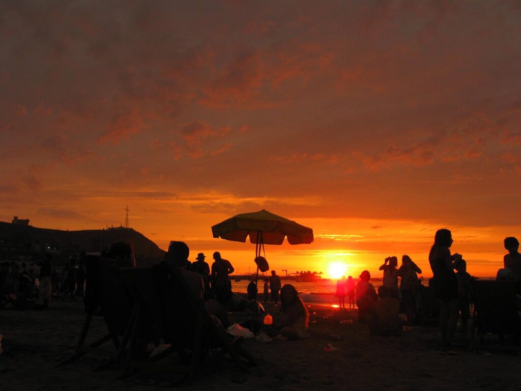
The best beaches and outdoor activities in Lima, Peru split three ways. The city’s own beaches, the pebbly Costa Verde below Miraflores and Barranco, are for surfing, sunsets and a walk on the sand rather than a swim. For calm water, go to La Punta in Callao or Agua Dulce in Chorrillos; for a real beach day, drive 36 to 59 km south to Punta Hermosa, Punta Negra, San Bartolo or Pucusana. And the best outdoor experiences aren’t on the sand at all: paragliding off the Miraflores cliffs, sea lions at the Palomino Islands, birds at Pantanos de Villa and the desert hills that turn green in winter.
This is for visitors who want sea air and open space between museum days, in any season. The caveat that matters is timing: beach season runs from about December to April, the water stays cold all year, and Peru’s health authority rated only 19 to 24 of Lima’s 73 monitored beaches healthy during summer 2026, with ratings that change week to week. Everything here was checked on September 24, 2026 against DIGESA and Ministry of Health reports, SERNANP, the municipalities and the operators’ own websites.
On this page: Compared · Beach season · Can you swim? · Miraflores and Barranco · Chorrillos and Pantanos de Villa · La Punta and the Palomino Islands · The southern beaches · Paragliding · The malecón on foot or by bike · El Olivar · The lomas · By season · Half-day plans · Staying safe outdoors · FAQ
Lima’s Beaches and Outdoor Activities Compared
Distances are by road from Parque Kennedy in Miraflores, the most common base; “free-flow” is the routing time with empty roads, which Lima’s traffic rarely allows.
| Place | Best for | From Miraflores | Season | Cost | Skip it if |
|---|---|---|---|---|---|
| Makaha and Waikiki, Miraflores | Surf lessons, watching surfers | 1.2 to 1.3 km, a 16 to 18 min walk | Surf all year | Free; lessons priced on request | You want soft sand and a swim |
| Barranco and Chorrillos city beaches | Sunset walks | 4 to 6 km | Summer | Free | You plan to swim: several were rated unfit in January 2026 |
| Agua Dulce, Chorrillos | A sandy family beach close to the city | 6.1 km, 8 min free-flow | December to April | Free | Its health rating that week is poor |
| La Punta, Callao | Calm water and a seafront promenade | 17.1 km, 19 min free-flow | Summer | Free | You’d have to cross Callao after dark |
| Punta Hermosa and Punta Negra | Surf breaks and beach towns | 36 to 41 km, 35 to 38 min free-flow | Summer; surf all year | Free | You only have half a day |
| San Bartolo | A calmer bay for swimming | 45.5 km, 42 min free-flow | December to April | Free | You’re visiting in the gray months |
| Palomino Islands boat trip | Swimming near sea lions | Pier on Plaza Grau, Callao | All year | S/ 160 adults with Tour Marino | You get seasick easily |
| Paragliding, Miraflores | A tandem flight along the cliffs | On the malecón | All year, wind permitting | S/ 180 to S/ 300 | You can’t wait around for the wind |
| Pantanos de Villa | Wetland birds | 15.5 km, 19 min free-flow | All year | Guided visit S/ 5 (municipal listing) | Birds aren’t your thing |
| Lomas de Lachay | Green desert hills in winter | About 105 km north, about 2 hours | June to November | S/ 30 general | You visit in summer, when the hills are dry |
| Bosque El Olivar, San Isidro | A shady walk among old olive trees | 2.6 km, a 34 min walk | All year | Free | You’ve already walked the malecón |
Each beach and activity on this list also gets its own detailed guide in this series.
When Is Beach Season in Lima?
Summer runs from about December to April: sunny, hot and humid, with the beaches full on weekends. From about June to November, Lima sits under a gray sky with morning drizzle, the garúa, and the beaches empty out, though the surfers don’t. It almost never rains properly in either season.
Summer is also school-holiday season for Peruvian families, so the beaches, the Panamericana Sur and the southern resorts are at their busiest on weekends from January to March, and again over Holy Week (March 25 and 26 in 2027). If you can choose, go south on a weekday.
The sea is the constant. The Humboldt current keeps the water off Lima cold for the tropics: about 20 °C on average in summer and 17 °C in winter. Surfers wear wetsuits all year, and even in February most visitors find a long swim bracing rather than balmy.
Sunsets over the Pacific are the other seasonal draw. By our calculation with NOAA’s solar equations, the sun sets at about 6:40 p.m. in mid-January and 5:51 p.m. in mid-June, but in the gray months the sunset is often a rumor. For month-by-month conditions, see the best time to visit Lima.
Can You Swim at Lima’s Beaches?
Sometimes, at the right beach, in the right week. Peru’s environmental health agency, DIGESA, rates the capital’s beaches through the summer on three things: the water’s microbiological quality, the cleanliness of the sand and whether the toilets and other facilities work. The results for summer 2026 were sobering. In late December 2025 only 19 of the 73 beaches monitored in Lima Metropolitana were rated healthy, and by late January 2026 the count was 24. Healthy beaches were concentrated in Miraflores, Barranco, Chorrillos, Ancón, Punta Hermosa, Punta Negra and Santa María del Mar, but individual beaches moved on and off the list: in January 2026 DIGESA rated Los Pavos and Las Sombrillas in Barranco and La Herradura and Villa in Chorrillos unfit for bathers, and Agua Dulce and a Punta Hermosa beach were among those rated unhealthy at points in the season.
The practical rule is to check the beach you have in mind the week you go, on DIGESA’s site, rather than trusting any list, including ours. Then add the other checks:
- Lifeguards. The UK Foreign Office warns there may not be lifeguards on beaches. Swim where others are swimming, stay within your depth and never swim alone.
- Board rentals. The FCDO also flags unauthorized surfboard rentals on the Miraflores beaches. Rent from a school.
- Cold water. At 17 to 20 °C, cold tires swimmers faster than they expect.
- Earthquakes. If a strong quake hits while you’re on the sand, climb to higher ground without waiting for a siren; the FCDO notes that higher tides often follow earthquakes.
Miraflores and Barranco: The Costa Verde Beaches
Below the Miraflores and Barranco cliffs runs the Costa Verde, a coastal highway with a string of pebble beaches between it and the sea. From Parque Kennedy, Playa Makaha is 1.2 km on foot, about 16 minutes, and Playa Waikiki next to it is 1.3 km, about 18 minutes, down through the clifftop parks and over the road. These are surf beaches first: long lines of swell break onto stones, and there are surfers in the water on most days of the year.
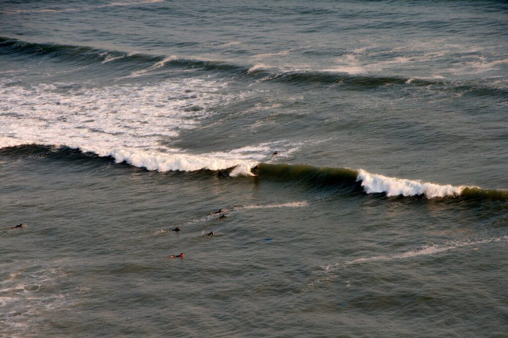
Learning to surf at Makaha
Makaha is where most beginners start. Kño Surf School, for example, teaches there every day from 6 a.m. to 6 p.m.: 90-minute lessons, either private or in groups of up to four students per instructor, with children’s classes from age 6, and board, wetsuit, leash and insurance included. It takes bookings by WhatsApp or phone and asks you to arrive 20 minutes early to suit up. It doesn’t publish prices online, so ask when you book. Whichever school you choose, book with a school rather than renting a board on the sand.
What to know before you go down
- The cliffs: the Costa Verde Project Authority has been repairing the mesh that holds the cliffs and has a protocol to close the road immediately after rockfalls, so stay off the base of the cliffs and follow any closure.
- The cable car: a teleférico from the Miraflores clifftop down to the Costa Verde was in the works, with fares reported in August 2026 before it had opened. Check whether it’s running before you plan around it.
- Swimming: the Barranco and Chorrillos city beaches had the worst health ratings in early 2026, so treat the Costa Verde as a walk and a sunset rather than a swim unless DIGESA says otherwise.
The guide to Lima’s neighborhoods covers the clifftop districts above these beaches.
Chorrillos: Agua Dulce, the Morro Solar and Pantanos de Villa
Playa Agua Dulce
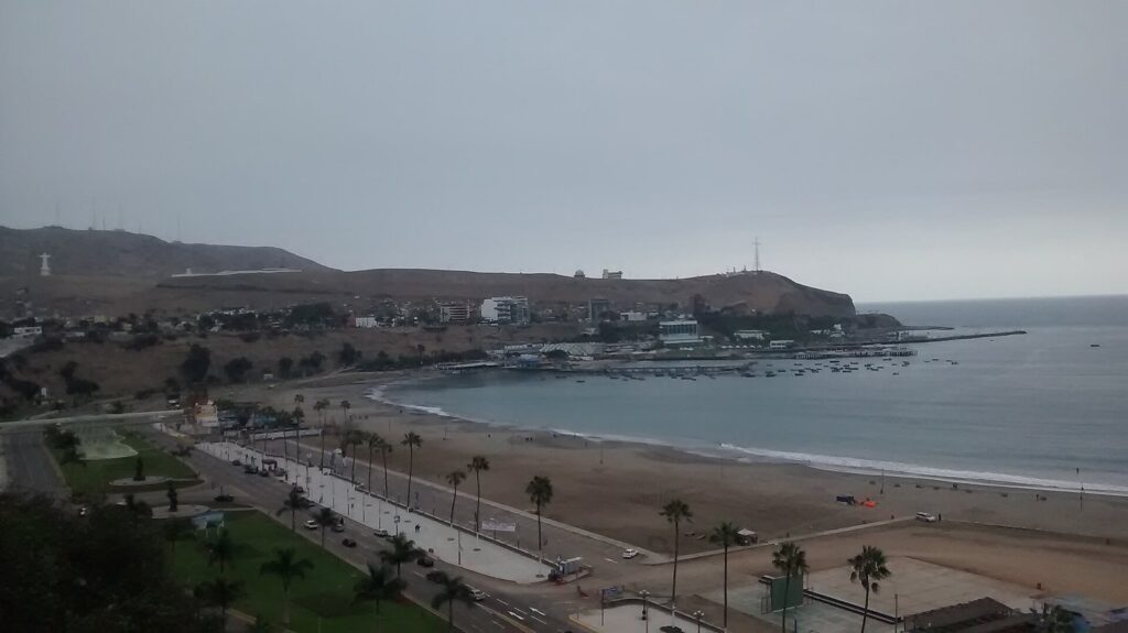
South of Barranco, the coast curves around the bay of Chorrillos, and Agua Dulce is its big, sandy public beach, 6.1 km from Parque Kennedy. It’s where many Lima families spend summer weekends, with a promenade behind the sand and the Morro Solar headland to the south. It’s the closest thing to a classic beach day inside the city, as long as its health rating that week is good.
The Morro Solar
The headland above Chorrillos carries the Cristo del Pacífico, a 37-meter statue of Christ inaugurated in 2011, and, according to the district municipality, a clifftop promenade of about 2 km branded the Gran Mirador de Lima, with a planetarium at the summit that dates from 1960. It’s 10.9 km from Parque Kennedy by road. Go on a clear summer afternoon for the view back along the whole bay; on a gray winter day there’s little to see.
Pantanos de Villa
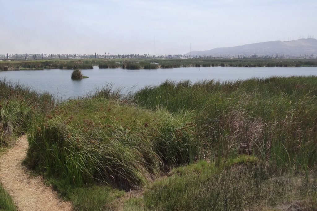
The Refugio de Vida Silvestre Los Pantanos de Villa, 15.5 km south of Parque Kennedy, is a 263-hectare wetland on the edge of Chorrillos, protected as a wildlife refuge since 2006 and listed as a Ramsar wetland of international importance. Reed beds and lagoons sit a few hundred meters from the sea, and it’s the easiest place near Lima to see waterbirds. A Municipality of Lima notice lists guided visits at S/ 5, with boat and canoe rides at S/ 5 and a catamaran at S/ 7; the notice isn’t dated, so confirm current prices and hours before you go. A birdwatching guide to the refuge follows in this series.
La Punta and the Palomino Islands (Callao)
La Punta
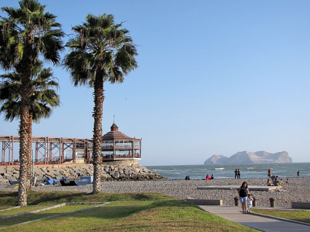
La Punta is the narrow peninsula at the tip of Callao, with a seafront promenade lined with old republican-era houses, calm water for swimming and seafood restaurants; PROMPERÚ notes it’s busiest in summer. It’s 17.1 km from Parque Kennedy, about 19 minutes with empty roads and up to an hour at Lima’s average city speed. Take a booked car to the promenade and back, in daylight, rather than walking through the port districts on the way; the Lima safety guide explains why.
The Palomino Islands
The Palomino islets, part of a SERNANP-managed reserve off Callao, are home to a large sea lion colony, and the boat trip out, with a swim in a wetsuit among the sea lions, is one of the most memorable things to do in Lima. SERNANP allows visits only with authorized operators and recommends visiting all year. Its rules are simple: always wear a life jacket, don’t feed the wildlife and follow the rangers’ and crew’s instructions.
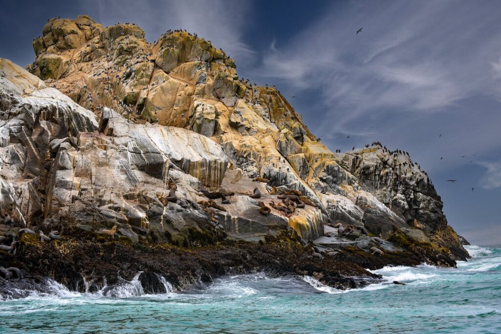
Plan it: Tour Marino departs daily, public holidays included, between 10 a.m. and 2 p.m. from the Muelle de Guerra on Plaza Grau; adults pay S/ 160 and children 4 to 12 S/ 130, with about 30 minutes at the islands and a life jacket included. IziPeru runs a 2-hour-30-minute speedboat trip leaving between 10 and 11 a.m., depending on the sea, with the SERNANP reserve fee and life jacket included; it asks for passport details. SERNANP’s visiting hours are 7 a.m. to 2:30 p.m. The day trips from Lima guide compares this with the longer excursions.
The Southern Beaches: Punta Hermosa to Pucusana
For a proper beach day, with sand, cleaner water and a holiday-town feel, Limeños head south down the Panamericana Sur. These are the four most useful stops, with road distances from Parque Kennedy:
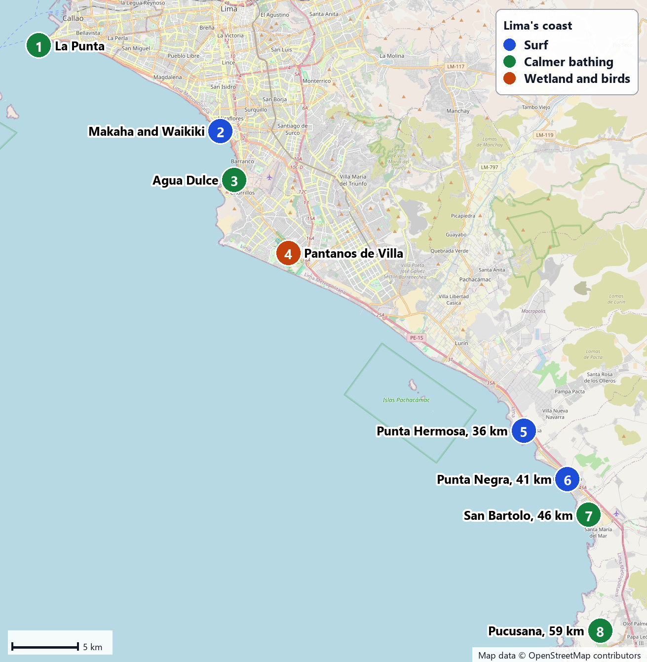
| Beach town | By road | Free-flow time | Best for |
|---|---|---|---|
| Punta Hermosa | 36.2 km | 35 min | Surf breaks and a lively summer scene |
| Punta Negra | 41.2 km | 38 min | More surf and a quieter town |
| San Bartolo | 45.5 km | 42 min | A calmer bay for swimming and water sports |
| Pucusana | 58.9 km | 59 min | The farthest of the southern resorts, a fishing cove |
PROMPERÚ describes Punta Hermosa as a resort known for its beaches, and the stretch from Punta Hermosa to Punta Negra holds the best-known surf breaks near Lima, such as Señoritas and Punta Rocas; San Bartolo, a little farther on, is the classic choice for swimming. Those free-flow times are the floor, not the forecast. Much of each trip is highway, but you first have to cross southern Lima, and at the city’s 2025 average speed the same distances would take two hours or more. The real figure usually lands in between, and summer weekends, when everyone has the same idea, are the slowest. Leave early, come back before the evening rush, and check each beach’s DIGESA rating before you choose, because in summer 2026 the healthy beaches in this stretch included spots in Punta Hermosa, Punta Negra and Santa María del Mar, while at least one Punta Hermosa beach was rated unhealthy at times.
Most visitors go by car, with a driver or on a tour, and the outing needs a full day. Punta Hermosa and San Bartolo each get a dedicated guide in this series.
Paragliding Over the Miraflores Cliffs
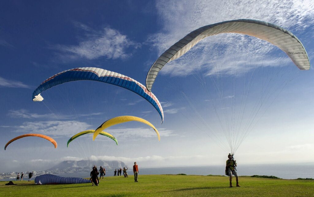
Tandem paragliding along the Miraflores cliffs is Lima’s signature outdoor thrill: you launch from the clifftop, ride the sea breeze along the edge of the city and land back where you started. Flights launch from the Parapuerto in Parque Antonio Raimondi on the malecón, run by three associations (APIPT, APTA and APVL), every day from 10 a.m. until sunset, when the wind allows.
| Operator or listing | Price | Details |
|---|---|---|
| Parapuerto de Miraflores (municipal listing) | S/ 300 or US$80 | Regular price; Miraflores residents with ID get 15% off |
| Infinity | S/ 260 | Includes video; service 10:30 a.m. to 5:30 p.m. |
| Condor Xtreme | S/ 180 a person, or S/ 340 for two | About 15 minutes with video and photos; launches from the Costa Verde esplanade in Magdalena del Mar, not the Parapuerto |
Two practical points. Flights depend on weather and wind, so don’t book one for your last afternoon in Lima; and in the gray months the view is softer, but the flying goes on. Paragliding gets its own guide in this series.
The Malecón on Foot or by Bike
The Miraflores malecón, the chain of clifftop parks above the Costa Verde, is 5.4 km long between the San Isidro and Barranco limits, and it’s the best free outdoor activity in Lima. The classic walk runs south from Parque Kennedy to Parque del Amor (993 m, about 13 minutes), past Larcomar and on to the Puente de los Suspiros in Barranco, 4.4 km and about an hour in all. Parque del Amor, opened on February 14, 1993, is built around Víctor Delfín’s sculpture El Beso.
A bike lane runs along the malecón; the municipality was renewing it in 2024, with 3.3 of its 5.4 km done that February. Miraflores has also announced a public bike system, CityBike Miraflores, reportedly with 50 stations and 500 bikes, so check the current rental options when you arrive. By day the malecón is an easy ride or walk; after dark, the safety advice is to take a car between districts rather than walking back along the clifftop. Walking and cycling routes along the malecón each get a detailed guide in this series.
Bosque El Olivar and Lima’s Green Spaces
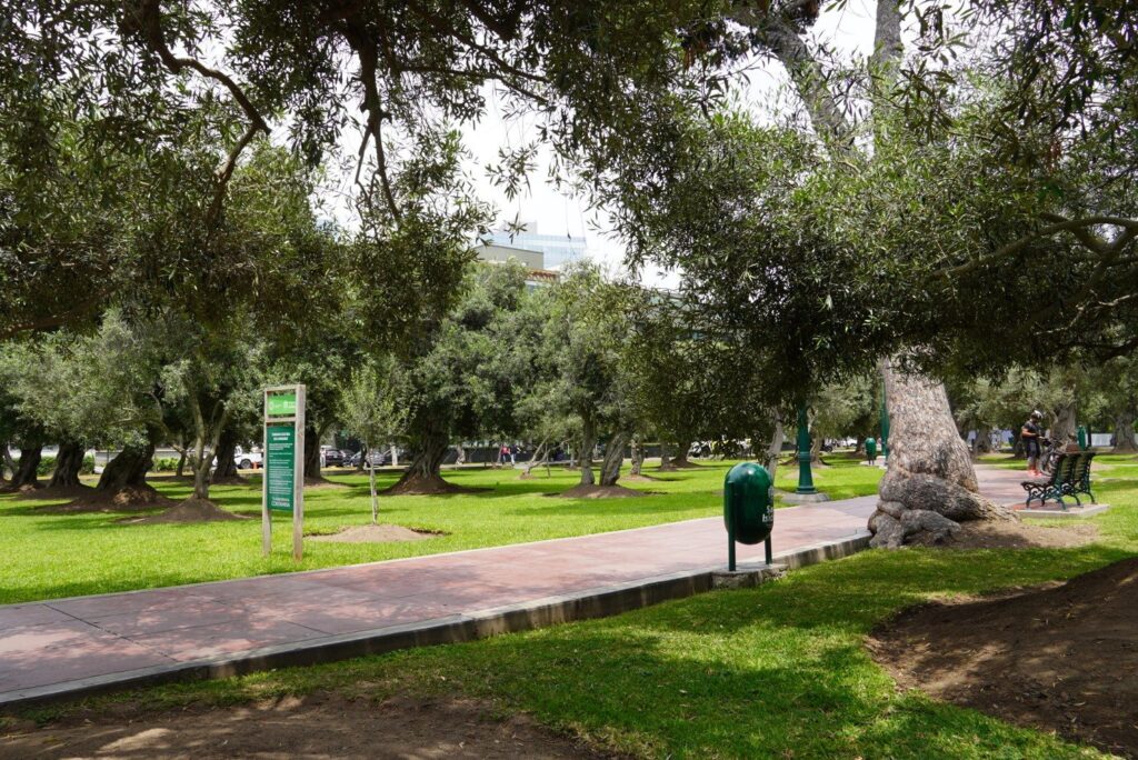
San Isidro’s Bosque El Olivar is an olive grove in the middle of the city: 1,946 trees over 10 hectares, some planted more than 350 years ago. It was declared a National Monument in 1959 and a Monumental Zone in 1998, and the district municipality credits Antonio de Rivera with bringing the first olive trees in 1560. It’s 2.6 km from Parque Kennedy, about 34 minutes on foot, and makes a quiet morning walk before a museum or lunch in San Isidro.
For a view of the whole city instead, Cerro San Cristóbal, across the river in Rímac, rises to 400 m and on clear days looks out to the Chorrillos and La Punta beaches and the islands of San Lorenzo and El Frontón. Go by taxi or with a tour, in daylight; the historic center guide covers the neighborhood at its foot.
The Lomas: Lima’s Desert Hills That Turn Green in Winter
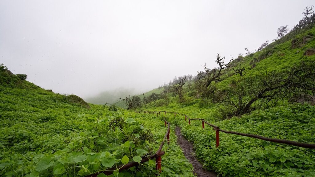
Lima’s most surprising outdoor sight appears when the beaches are empty. From about June to November, the winter mist settles on the coastal hills around the city and turns them green, creating the lomas, seasonal ecosystems of grass, flowers and small trees in the middle of the desert. There are about ten around Lima, and they’re greenest from about July to October.
| Lomas | Where | Cost | How to visit |
|---|---|---|---|
| Reserva Nacional de Lachay | About 105 km north of Lima, about 2 hours by road | S/ 30 general entry | On your own, no operator needed; open daily 8 a.m. to 3 p.m.; SERNANP recommends June to November |
| Lomas de Lúcumo | Quebrada Verde, Pachacámac, 20.8 km from Parque Kennedy | S/ 10 from age 12, S/ 5.50 for children 3 to 11 | Organized groups with a mandatory local guide, booked ahead; best July to October |
| Lomas de Paraíso | Villa María del Triunfo, south Lima | Check with the local group | Contact the conservation group first about the route, hours and guided walks |
Lachay is a full day and the easiest to do independently; Lúcumo pairs well with a morning at Pachacamac. The guide to day trips from Lima covers both with door-to-door times.
Which Outdoor Activities Work in Which Season?
Lima’s outdoors changes more with the season than its museums do. Use this to match your dates to the right plan:
| Activity | December to April (summer) | May | June to November (gray months) |
|---|---|---|---|
| Beach days and swimming | Best: sunny, busy and warmest water, around 20 °C | Fading | Cold water and gray skies; few people swim |
| Surf lessons | Yes | Yes | Yes, in a wetsuit |
| Paragliding | Yes, when the wind allows | Yes | Yes; softer views under cloud |
| Palomino Islands boats | Yes | Yes | Yes; SERNANP recommends visiting all year |
| Sunset on the clifftop | Best, around 6:25 to 6:40 p.m. | Hit or miss | Often hidden by cloud, around 5:50 to 6:05 p.m. |
| The lomas | Dry and brown | Starting to green | Best: green from about June to November, greenest July to October |
| Pantanos de Villa and El Olivar | Yes | Yes | Yes |
If your trip falls in the gray months, don’t write off the outdoors: swap the beach for the lomas, keep the surf lesson and the paragliding, and save the sunny-day plans for a museum afternoon at one of the places in the guide to Lima’s museums and art galleries.
Five Outdoor Half-Days From Miraflores
Each of these fits in a morning or an afternoon from a Miraflores base, using the distances and hours above.
- The clifftop and a surf lesson: walk from Parque Kennedy to Parque del Amor (about 13 minutes), down to Makaha for a 90-minute lesson, then back up and along the malecón toward Barranco. Book the lesson a day ahead.
- Sea lions and La Punta: take a booked car to Plaza Grau in Callao for a 10 a.m. boat to the Palomino Islands, then a late lunch on the promenade at La Punta. Bring passport details for the boat and a towel.
- Chorrillos at sunset (summer): an afternoon on the sand at Agua Dulce, 6.1 km from Parque Kennedy, then up to the Morro Solar for the view back over the bay as the sun goes down. Book a car home.
- Birds and a sanctuary: Pantanos de Villa in the early morning, 15.5 km south, then on to the Pachacamac sanctuary, 24 km from Parque Kennedy, which closes on Mondays. The day trips guide has the timings for Pachacamac.
- A green winter morning (June to November): Lomas de Lúcumo with its community guides, booked ahead, 20.8 km from Parque Kennedy. For Lachay, allow a full day: it’s about two hours each way and closes at 3 p.m.
All five depend on a car at one end or both. The guide to getting around Lima explains how to book one safely, and the Lima travel budget guide shows what the tickets add up to.
Beaches and Outdoors With Kids or Limited Mobility
With children, the calm water at La Punta and the sand at Agua Dulce are the easiest beaches, always subject to that week’s health rating. Surf schools such as Kño teach children from age 6, the Palomino boats take children (Tour Marino charges S/ 130 for ages 4 to 12), and the malecón’s clifftop parks have space to run with the ocean safely below. Lima with children gets its own guide in this series.
With limited mobility, the Miraflores malecón is the most accessible outdoor space in the city: flat, paved and continuous along the clifftop, though curbs and crowds vary. The pebble beaches below are hard going, and boats and the lomas trails aren’t built for wheelchairs. Pachacamac offers a free service that takes visitors with reduced mobility around its circuit, Tuesday to Friday, if you book it at the ticket office.
What to Pack for a Lima Beach or Outdoor Day
- For the beach: sunscreen and a hat in summer, water shoes or sandals for the pebbles, a towel, and cash in small notes for snacks and parking.
- For the water: a wetsuit if you plan more than a quick dip; surf schools include one with a lesson.
- For the Palomino boats: swimwear, a towel and passport details; IziPeru, for one, lists swimwear and towel as not included.
- For the lomas and Pantanos: closed shoes, a warm layer against the winter mist, water and snacks; Lachay is in the desert, far from shops.
- Always: a phone with a ride app set up and a way to book a car back before you set off.
Staying Safe Outdoors in Lima
- Sun: the summer sun is strong even when the air feels mild, so use sunscreen, a hat and water on the beach and in the lomas.
- Belongings: don’t leave a bag on the sand while you swim; bring only what you need, and keep your phone zipped away on the promenades.
- Getting home: book a car back from the beaches, La Punta and Chorrillos rather than looking for one on the road, especially after dark.
- The cliffs: stay off the base of the Costa Verde cliffs and follow road closures after rockfalls.
- Water: check DIGESA’s rating, swim near other people, and respect the cold.
- Earthquakes: on any beach, a strong quake means heading straight up to higher ground.
To fit a beach or outdoor morning into a longer stay, the Lima itinerary for first-time visitors shows where it slots between the museums and the historic center, and the best things to do in Lima puts the coast alongside everything else.
Lima Beaches and Outdoors FAQ
Can you swim in the ocean in Lima?
Yes, at some beaches and in some weeks. DIGESA rated only 19 to 24 of Lima’s 73 monitored beaches healthy during summer 2026, and the list changed through the season. The water is cold, about 17 to 20 °C, and there may be no lifeguard. Check the current rating, swim near others and stay within your depth.
What is the best beach near Lima?
For swimming, the southern beaches such as San Bartolo, 45.5 km from Miraflores, usually beat the city beaches, as long as that week’s health rating is good. For surfing, Punta Hermosa’s breaks are the best known. Within the city, Agua Dulce in Chorrillos is the easiest sandy beach and La Punta in Callao has the calmest water.
Is Lima good for surfing?
Yes, and all year. The Miraflores beaches, especially Makaha, are where most people take lessons, with schools running 90-minute sessions that include a wetsuit and board. Experienced surfers head south to the breaks around Punta Hermosa. Wear a wetsuit in every season, because the water stays cold.
How much does paragliding in Miraflores cost?
The municipal listing gives a regular price of S/ 300 (US$80) for a tandem flight from the Parapuerto, and operators list lower prices: Infinity S/ 260 with video, and Condor Xtreme S/ 180 a person from Magdalena del Mar. Flights run daily from 10 a.m. until sunset but depend on the wind, so keep your schedule flexible.
When is the best time for the beach in Lima?
December to April, Lima’s summer, when the skies are sunny and the beaches busy. From about June to November the coast is gray and the beaches are quiet, though surfing and paragliding carry on. Winter has its own outdoor highlight: the lomas, the desert hills that turn green in the mist from about June to November.
Is there a beach within walking distance of Miraflores?
Yes. From Parque Kennedy, Playa Makaha is 1.2 km on foot, about 16 minutes, and Playa Waikiki is 1.3 km, about 18 minutes, down through the clifftop parks and over the Costa Verde road. They’re pebble beaches best for surfing and watching the sunset; for sand, Agua Dulce in Chorrillos is 6.1 km by road.
How do I get to the southern beaches from Lima?
By car, with a driver or on a tour. Punta Hermosa is 36.2 km from Parque Kennedy and San Bartolo 45.5 km, about 35 to 42 minutes on empty roads, but crossing southern Lima usually adds a lot more. Leave early, return before the evening rush and avoid summer Sunday afternoons if you can.
Related Lima Guides
- Best Day Trips From Lima, Peru: Door-to-Door Times, Costs and Verdicts: the Palomino Islands, the lomas and Pachacamac.
- Best Time to Visit Lima, Peru by Weather and Activities: beach season, the gray months and sunsets.
- Best Lima Neighborhoods for Tourists: Miraflores, Barranco and Chorrillos above the beaches.
- Is Lima Safe for Tourists? Practical Guide: beaches, cliffs, taxis and earthquakes.
- Best Things to Do in Lima, Peru for First-Time Visitors: the coast alongside the city’s other highlights.
- Lima, Peru Itinerary for First-Time Visitors: 1 to 5 Days: where an outdoor morning fits.
Sources and How We Checked
Prices, hours, ratings and closures were checked on September 24, 2026 against the sources listed below. This guide is compiled from those sources rather than from other travel lists, and it claims no first-hand visits.
- DIGESA and the Ministry of Health: DIGESA; Verano Saludable 2026 campaign; reports in Infobae, January 2026, La República, December 2025, Gestión and RPP
- SERNANP: protected-area visits, including the Palomino Islands and Lachay; Pantanos de Villa
- Municipality of Lima: Pantanos de Villa visits; SERPAR: Cerro San Cristóbal
- Municipality of Miraflores: Parapuerto de Miraflores; malecón, bike lane and Costa Verde notices; Municipality of San Isidro: Bosque El Olivar; Municipality of Chorrillos: Morro Solar and Cristo del Pacífico
- PROMPERÚ: Peru Travel, Lima; beaches of Metropolitan Lima
- Operators: Kño Surf School; Tour Marino Isla Palomino; IziPeru; Infinity; Condor Xtreme; Lomas de Lúcumo community association
- UK Foreign, Commonwealth and Development Office: Peru safety and security
- Climate and sea: SENAMHI; NOAA solar calculator equations for sunset times; IGN sea-temperature data
- Routing: OpenStreetMap data via OSRM; drive times compared with TomTom’s 2025 Traffic Index averages for Lima
Lima Tourism Guide is an independent publication. We are not affiliated with PROMPERÚ, the Municipality of Lima or any attraction listed here, and no one paid to be included.
Photo Credits
- Sunset at Playa Agua Dulce, Chorrillos: photo by Afrikaeditx, Wikimedia Commons (CC BY-SA 4.0)
- Surfers off Miraflores: photo by Christian Haugen, Wikimedia Commons (CC BY 2.0)
- Playa Agua Dulce and the bay of Chorrillos: photo by Wasiwatana, Wikimedia Commons (CC BY-SA 4.0)
- Laguna Principal, Pantanos de Villa: photo by Jeffreyroth, Wikimedia Commons (CC BY-SA 3.0)
- Seafront at La Punta, Callao: photo by sergejf, Wikimedia Commons (CC BY-SA 2.0)
- Sea lions, Palomino Islands: photo by Kalitoddtravel, Wikimedia Commons (CC BY-SA 4.0)
- Map of Lima's coast and beaches: Lima Tourism Guide, drawn from map data © OpenStreetMap contributors (ODbL)
- Paragliders on the Miraflores clifftop: photo by Andrearubin, Wikimedia Commons (CC BY 3.0)
- Bosque El Olivar, San Isidro: photo by Futuropopular, Wikimedia Commons (CC BY-SA 4.0)
- Lomas de Lachay in winter: photo by Correliebre, Wikimedia Commons (CC BY-SA 4.0)